
AI-Powered Voyage Optimization for Smarter Routing
January 29, 2026
Voyage optimization is no longer a nice to have, it sits at the center of profitable, compliant operations. Fuel is still one of the largest operating costs for most fleets, and even small percentage improvements in consumption now translate directly into margin and competitiveness.
Meanwhile, regulators are tightening the screws: CII introduces annual efficiency ratings, and SEEMP III demands a documented plan to improve performance over time.
Running the same routes at the same speeds as five years ago is no longer workable, financially or regulatory-wise.
On top of this, the operating environment itself is more volatile. Weather systems are less predictable, coastal congestion is increasing, and more ports are enforcing local environmental restrictions.
A route that looks optimal on a static chart can quickly become inefficient when head seas, adverse currents, or traffic constraints force last-minute changes. Every unplanned speed-up to catch up on ETA comes with a fuel and emissions penalty.
For fleet managers, voyage planners, and technical superintendents, the challenge is clear: they need a way to bring weather data, vessel behavior, and commercial targets into one decision framework.
Traditional routing methods and manual spreadsheet-based planning cannot process these variables in real time or at fleet scale.
That is why modern voyage optimization is shifting toward data-driven, AI-supported decision tools that help teams continuously adjust route, speed, and ETA, before small inefficiencies become costly problems.
Optimize Route, Speed, and ETA with Data-Driven Decision Support
Voyage optimization is fundamentally about choosing the safest and most efficient path from departure to arrival while conditions continuously change.
It is not just route selection on a chart, it is the active management of speed, power, and timing in response to weather, sea state, current, and operational constraints. A well-optimized voyage balances three priorities at once: maintaining safety margins, reducing fuel consumption, and achieving a precise ETA.
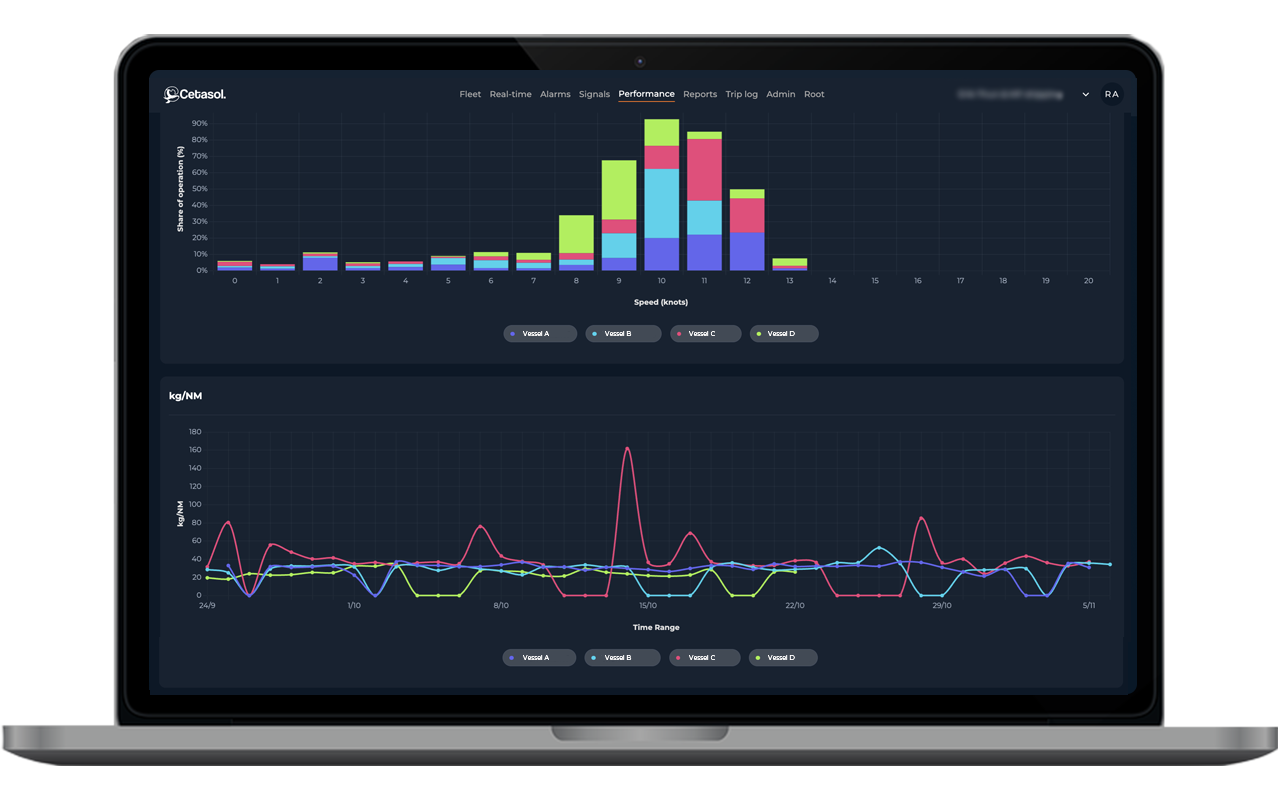
Speed is the most influential variable in this equation. Even small changes in RPM can have an outsized impact on fuel burn, sometimes increasing consumption exponentially when the vessel is pushed through heavy seas or strong headwinds.
When speed decisions are made late, for example, if a vessel slows down too much in bad weather and then has to accelerate aggressively to meet its ETA, operators pay twice: higher fuel consumption and higher emissions. Poorly timed speed changes also increase engine load variation, which can raise long-term maintenance risk.
This is why the industry is moving away from reactive “adjust as you go” planning. Modern decision-support systems give crews and planners a predictive view of the voyage.
By combining vessel behavior data with weather forecasts and operational targets, these tools recommend optimal speed profiles and highlight when route adjustments will save fuel without jeopardizing arrival time. Instead of compensating for delays after they occur, operators can anticipate them and choose the most efficient strategy in advance.
Key Variables That Shape Voyage Efficiency
Voyage efficiency is shaped by a combination of environmental forces, vessel characteristics, navigational restrictions, and regulatory pressures. Each variable influences the fuel required to maintain speed and the vessel’s ability to meet its ETA. Understanding these drivers is the foundation of any effective optimization strategy.
Weather & Sea State
Weather is often the biggest determinant of fuel consumption.
- Wind speed and direction directly affect hull resistance. Headwinds can force the vessel to burn significantly more fuel to maintain speed, while tailwinds can reduce power requirements.
- Wave height, period, and swell influence vessel motions and engine load. Long-period swell from an off-angle can slow a vessel even when local winds are calm.
- Currents and tidal streams act either as a conveyor belt or an opposing force. A favorable current can reduce fuel burn with no change in RPM, while an adverse current can overwhelm planned speed profiles.
Vessel-Specific Factors
No two vessels behave the same, even if they are identical on paper.
- Load condition changes draft and hull resistance, altering optimal speed settings.
- Hull and propeller conditions, such as fouling or surface degradation, can increase fuel consumption at the same RPM.
- RPM profile and power usage define the vessel’s fuel curve. Operating slightly below peak resistance points often yields substantial fuel savings without affecting ETA.
Navigational Constraints
Operational reality imposes limits that must be incorporated into any route plan.
- Traffic separation schemes (TSS) require specific routing corridors that may not be fuel-optimal.
- Restricted zones, environmental control areas, and military zones can force detours.
- Port windows and tidal access requirements can dictate arrival times, affecting speed choices earlier in the voyage.
Economic & Regulatory Drivers
Efficiency is no longer only about cost, it directly affects compliance.
- Fuel price and consumption patterns make every avoided RPM increase financially meaningful.
- CII ratings link emissions performance to annual operational evaluations. Poorly optimized voyages can result in unnecessary fuel burn that hurts a vessel’s rating.
- SEEMP III goals require continuous improvement plans; optimization strategies must show how operational decisions reduce emissions over time.
Together, these variables create a dynamic operating environment where static routing is no longer adequate. Modern optimization requires systems capable of processing all of these inputs simultaneously and adjusting guidance as conditions evolve.
AI-Powered Route Planning and Decision Support
Adaptive AI is reshaping how operators plan and execute voyages. Instead of relying on static routes or manual adjustments, AI evaluates speed, routing, and power settings across multiple possible scenarios.
It assesses how changing weather, currents, and vessel behavior will affect fuel use and ETA, giving crews a clearer picture of the trade-offs before decisions are made.
AI in the maritime context is not autonomous navigation. It does not steer the vessel or override the operator. Its role is advisory: to analyze large volumes of data, identify patterns that humans cannot see in real time, and recommend the most efficient course of action. The captain and crew remain fully in control, with AI providing the insights needed to operate optimally.
Because the models are adaptive, they continue to learn from every voyage. Engine trends, vessel response in different sea states, and operational patterns all feed into the system.
Over time, the AI becomes more precise in predicting fuel use and recommending speed adjustments, even for vessels of identical design that behave differently in practice.
iHelm applies this adaptive, data-driven approach directly to daily vessel operations:
- iHelm analyzes real-time operational data, including GPS and available engine signals to build and update a data-driven model of the vessel.
- Using this model, iHelm recommends optimal speed and power settings that help reduce fuel consumption while maintaining the intended arrival time.
- The system compares multiple scenario outcomes based on weather, sea conditions, and operational constraints, allowing crews to understand how different choices will affect efficiency.
- Guidance is always actionable and operator-focused, supporting the crew without replacing human judgment.
- Because iHelm continuously learns from the vessel’s operations, recommendations become increasingly accurate, enabling more consistent performance over time.
By combining adaptive AI with a continuously updated digital twin, iHelm turns complex operational data into practical decision support, helping operators stay efficient without compromising safety or schedule discipline.
Using Digital Twins to Simulate Optimal Voyages
A digital twin, as defined by Cetasol, is a data-driven operational model built from real vessel signals, not a 3D visualization or design replica. It uses continuous inputs such as GPS, engine parameters, power usage, and operational patterns to reflect how the vessel actually behaves under different conditions.
Because it updates in real time, the model becomes increasingly accurate and aligned with the vessel’s true operational profile.
This data-driven model allows operators to evaluate the expected effects of different routing or speed choices before applying them. Instead of relying on theoretical performance curves, the digital twin uses measured behavior to predict fuel use, ETA outcomes, and the effect of changes in weather or sea state.
This is valuable because even identical ships rarely operate the same, differences in hull condition, loading, and crew behavior create unique performance signatures. Cetasol’s approach captures these differences automatically through continuous data collection.
How Cetasol Uses the Digital Twin Model in iHelm
Cetasol integrates the digital twin directly into the iHelm Intelligent Platform, creating a continuously updated, data-driven model of each vessel using engine signals, GPS, and operational history.
This allows iHelm to estimate fuel use for different speed and route combinations and compare “what-if” voyage scenarios before execution. Because the model reflects real vessel behavior, guidance is vessel-specific and far more accurate than theoretical curves.
By combining this digital twin with real-time decision support, iHelm provides decision support that helps operators evaluate routing options, understand fuel implications, and choose strategies that reduce unnecessary fuel burn, and reduce operational risk, all without additional sensors or onboard complexity.
Weather Data Integration for Smarter Routing
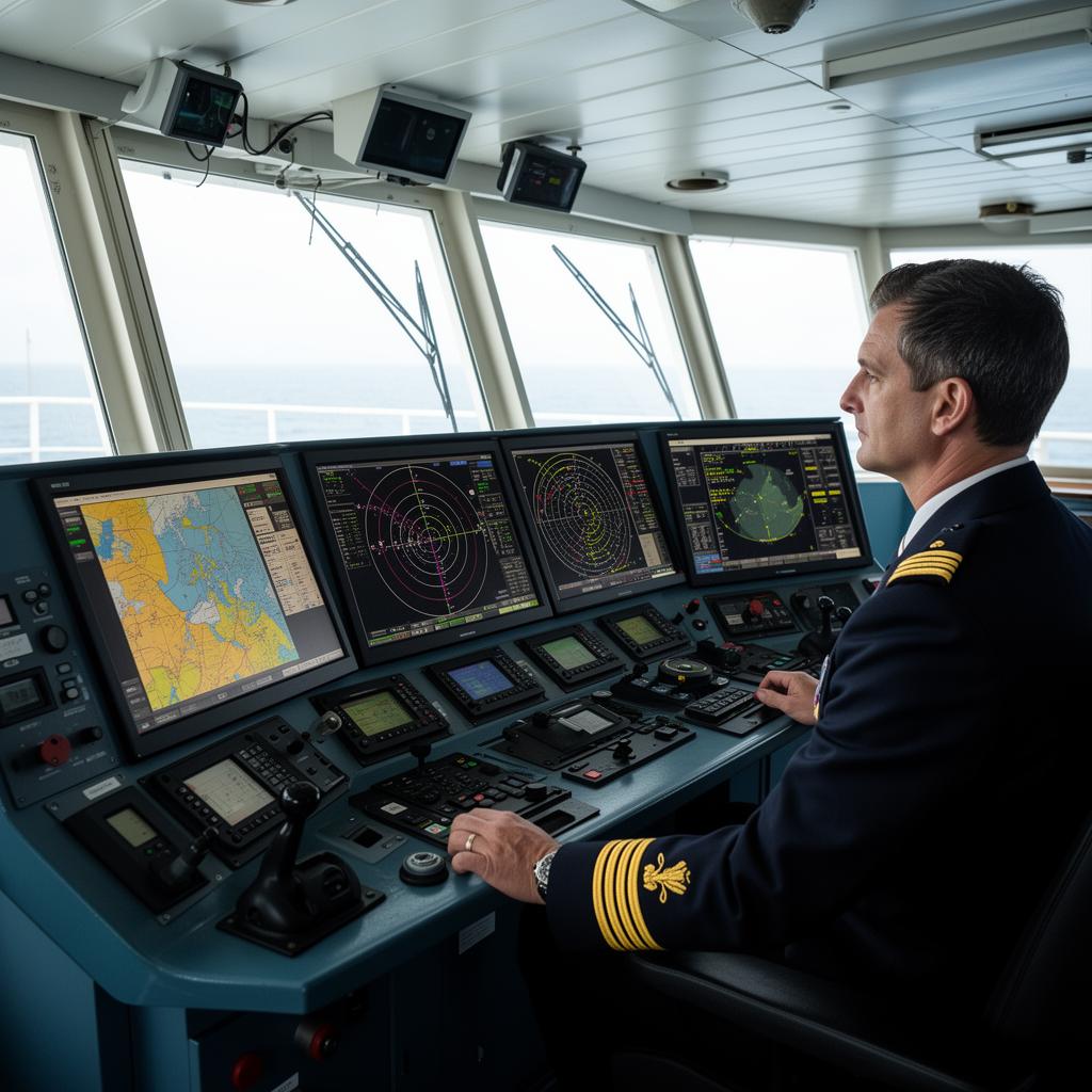
Weather routing only works as well as the data behind it. Modern platforms integrate real-time, high-resolution weather data with vessel performance models to recommend routes that balance safety, speed, and fuel efficiency.
Instead of relying on static forecasts or manual interpretation, operators now get continuously updated insights that adapt to changing conditions throughout a voyage.
Integrating weather data transforms routing from a basic navigational task into a predictive optimization process. These systems ingest winds, waves, currents, and ocean conditions; combine them with vessel characteristics; and generate route options that minimize risk and fuel burn. Crucially, optimal does not mean fastest.
The smartest route is the one that avoids damaging weather, protects crew and cargo, reduces engine load, and aligns with business constraints such as CO₂ targets or charter-party terms.
By embedding real-time weather intelligence into voyage planning, operators unlock several advantages:
- Lower operating costs – More efficient routing cuts fuel consumption, reduces exposure to expensive weather-related insurance claims, and helps avoid crew overtime or port penalty fees.
- Greater safety – Extreme weather remains a major cause of ship losses worldwide. Weather-aware routing reduces exposure to storms, heavy seas, and hazardous swell patterns, protecting both crews and assets.
- Decarbonization progress – Smarter routing directly supports IMO emissions targets. Avoiding inefficient weather conditions reduces unnecessary fuel burn and can meaningfully contribute to the industry’s required emissions cuts.
- Significant fuel savings – Weather-optimized voyages typically save fuel consumption.
- Fewer delays – Weather-driven slowdowns compound global port congestion. Using accurate, real-time weather insights helps vessels anticipate adverse conditions and avoid or mitigate delay-inducing scenarios.
Do you want to turn weather challenges into fuel savings and more accurate ETAs? See how iHelm uses real-time forecasts to support smarter operational decisions.
The Compliance Angle: How Optimized Voyages Improve CII & SEEMP Scores
Voyage optimization is not only a cost and efficiency strategy, it is now a compliance requirement. Because fuel consumption is directly tied to emissions output, every operational decision made during a voyage affects a vessel’s carbon footprint.
Lower fuel use translates into lower CO₂ emissions, which directly influences regulatory performance across the fleet.
Impact on CII Ratings
CII (Carbon Intensity Indicator) is assessed on an annual basis, and a vessel’s rating reflects its operational efficiency over the entire year.
Optimized routing and speed management help reduce total emissions per transport work, improving the vessel’s CII score. Even modest reductions in fuel use across multiple voyages accumulate into meaningful improvements when the annual rating is calculated.
Conversely, inefficient routing or unnecessary high-power segments can push the vessel toward poorer ratings, requiring corrective actions.
Support for SEEMP III and Continuous Improvement
SEEMP III requires documented, data-backed strategies that show how ship operators plan to improve their energy performance over time. Voyage optimization provides one of the clearest pathways to meeting these requirements.
By planning routes that avoid high-resistance weather, adjusting speed profiles proactively, and smoothing power demand, operators can demonstrate measurable progress in reducing emissions intensity. The ability to review historical voyages and compare performance year-on-year is central to achieving SEEMP III alignment.
Automated Reporting Reduces Administrative Burden
Regulatory frameworks such as MRV and IMO DCS require consistent, accurate reporting of fuel consumption, distance traveled, and operational parameters.
Manual reporting consumes time and introduces risk of error. When optimization tools collect, organize, and structure this data automatically, compliance becomes significantly more efficient.
Voyage records, emission figures, and performance metrics can be exported without recreating logs or calculations by hand.
Final Thoughts: Turn Planning into a Predictive System
Voyage planning is moving beyond manual interpretation and static routing. The industry is shifting toward predictive, data-driven decision support, where speed, routing, and power settings are guided by real-time insights rather than after-the-fact corrections.
AI, integrated weather data, and data-driven digital twin models allow operators to anticipate resistance, support fuel-efficient operation, and maintain schedule precision with far greater confidence.
When this predictive approach is applied consistently, optimization becomes a continuous process at both vessel and fleet level. Each voyage contributes new operational data, strengthening the model and improving recommendations over time. This leads to smoother operations, reduced emissions, and more reliable compliance performance.
Cetasol supports this shift on multiple fronts.
iHelm turns real operational data into actionable guidance, helping crews make efficient decisions in real time.
CetaFuel, Cetasol’s virtual fuel reader, provides virtual fuel estimation with 97–99.5% accuracy using operational signals with no physical sensors required. By giving operators precise fuel insights at a fraction of traditional cost, CetaFuel strengthens optimization efforts and makes fuel performance transparent across the fleet.
Together, iHelm and CetaFuel create a predictive foundation for modern voyage planning, one that reduces uncertainty, cuts costs, and supports long-term sustainability goals.